Sicily Island is a village in Catahoula Parish, Louisiana, United States. The population was 336 at the 2020 census.

Kisatchie National Forest, the only National forest in Louisiana, United States, is located in the forested piney hills and hardwood bottoms of seven central and northern parishes. It is part of the Cenozoic uplands and has large areas of longleaf pine forests. It is one of the largest pieces of natural landscape in Louisiana, with some 604,000 acres (2,440 km2) of public land, more than half of which is vital longleaf pine and flatwoods vegetation. These support many rare plant and animal species. There are also rare habitats, such as hillside seepage bogs and calcareous prairies. The forest also contains and provides a buffer for the Kisatchie Hills Wilderness, a nationally designated wilderness area that contributes to protecting biodiversity of the coastal plain region of the United States.
The Boeuf Wildlife Management Area is 51,110-acre (20,680 ha) parcel of bottomland hardwoods, cypress-tupelo swamp, and other wetland habitats in northeast Louisiana. It is owned by the Louisiana Department of Wildlife and Fisheries. Boeuf Wildlife Management Area is located in Caldwell and Catahoula Parishes, near the city of Columbia, Louisiana.
The Atchafalaya National Wildlife Refuge is located about 30 miles (48 km) west of Baton Rouge, Louisiana, and one mile (1.6 km) east of Krotz Springs, Louisiana, lies just east of the Atchafalaya River. In 1988 under the administration of Governor Foster the "Atchafalaya Basin Master Plan" was implemented that combined the 11,780-acre (4,770 ha) Sherburne Wildlife Management Area (WMA), the 15,220-acre (6,160 ha) Atchafalaya National Wildlife Refuge, and the 17,000-acre (6,900 ha) U.S. Army Corps of Engineers' Bayou Des Ourses into the Sherburne Complex Wildlife Management Area.
Loggy Bayou is a 17.3-mile-long (27.8 km) stream in northwestern Louisiana which connects Lake Bistineau with the Red River. Bistineau is the reservoir of Dorcheat Bayou, which flows 115 miles (185 km) southward from Nevada County, Arkansas, into Webster Parish. Loggy Bayou flows through south Bossier Parish, west of Ringgold, in a southerly direction through Bienville Parish, and into Red River Parish, where north of Coushatta it joins the Red River, a tributary of the Mississippi. At East Point, LA, the river has a mean annual discharge of 1,960 cubic feet per second.
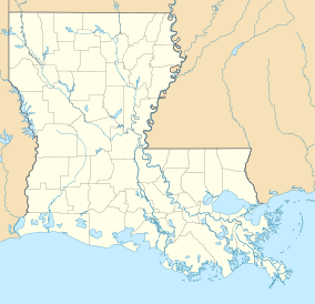
Pass a Loutre Wildlife Management Area (WMA) is a 115,000-acre (47,000 ha) protected wetland in Plaquemines Parish, Louisiana, United States. The WMA is located due south and bordering the 48,000 acre Delta National Wildlife Refuge, accessible only by air or boat, contains the Pass A L'Outre Lighthouse, and Port Eads is within the boundary.
The Sherburne Complex is a joint land management venture of the U.S. Fish and Wildlife Service, the Louisiana Department of Wildlife and Fisheries (LDWF), and the U.S. Army Corps of Engineers that began in 1983. The area consists of 43,637 acres (17,659 ha), and is managed by the Louisiana Department of Wildlife and Fisheries. The complex is located in the Morganza Flood way system of the Atchafalaya Basin about 30 miles (48 km) west of Baton Rouge, Louisiana and actually extends a little south of the I-10 Atchafalaya Basin Bridge at Whiskey Bay, Louisiana. The bridge crosses the Whiskey Bay Pilot Channel. Located on the graveled LA 975, the west boundary is on the east side of the Atchafalaya River with the east boundary being the East Protection Levee. The complex stretches just north of old highway 190, and a short distance to the south of I-10. The nearest town is Krotz Springs to the north off US 190.
Attakapas Wildlife Management Area, also known as Attakapas Island Wildlife Management Area, is a 27,962-acre tract of protected area located in St. Mary, St. Martin, and Iberia Parishes, Louisiana. The property was acquired in 1976 and is under the authority of the Louisiana Department of Wildlife and Fisheries (LDWF). The LDWF has 25,730 acres and the USACOE has 2,200 acres.
Elm Hall Wildlife Management Area is a 2,839-acre (1,149 ha) protected area in Assumption Parish, Louisiana. The WMA is located five miles west of Napoleonville, with Lake Verret on the western border, farmland to the east, and is managed by the Louisiana Department of Wildlife and Fisheries (LDWF).
Clear Creek Wildlife Management Area is a 52,559-acre (21,270 ha) tract of protected area located in Vernon Parish, Louisiana. The Louisiana Department of Wildlife and Fisheries (LDWF) leases the land from Hancock Timber.
Dewey W. Wills Wildlife Management Area, also just called Dewey Wills Wildlife Management Area and formally known as the Saline Wildlife Management area, is a 63,984-acre (25,893 ha) tract of protected area located in LaSalle Parish, Catahoula Parish, and Rapides Parish, in Central Louisiana. The Louisiana Department of Wildlife and Fisheries (LDWF) owns 63,901 acres, the LaSalle Parish School Board owns 1530 acres, and the U.S. Army Corps of Engineers (USCOE) owns 265 acres, managed by the LDWF.
The Richard K. Yancey Wildlife Management Area, formerly the Red River/Three Rivers Wildlife Management Area, is a 70,872-acre (28,681 ha) tract of protected area in lower Concordia Parish, Louisiana. The area is owned by the Louisiana Department of Wildlife and Fisheries and the U.S. Army Corps of Engineers (USACOE). The WMA is located off LA 15 approximately 35 miles (56 km) south of Ferriday between the Red River and the Mississippi River.
Biloxi Wildlife Management Area also referred to as Biloxi WMA, is a 35,644-acre (14,425 ha) privately owned tract of protected marsh land located in St. Bernard Parish, Louisiana, managed by the Louisiana Department of Wildlife and Fisheries (LDWF). The land is owned by Biloxi Marsh Lands Corporation, owning approximately 90,000 acres (36,000 ha) of land in St. Bernard Parish, that started leasing land to the LDWF as early as 1957. Access is limited to boats as there are no roads in the WMA. The nearest road access is LA 46 to Shell Beach or LA 624 to Hopedale.
Fort Johnson North Wildlife Management Area, known locally as Peason Ridge WMA, is a 74,309-acre tract of protected area located in the Parishes of Natchitoches, Sabine, and Vernon, in the state of Louisiana. The WMA is managed by the Louisiana Department of Wildlife and Fisheries (LDWF).
Salvador Wildlife Management Area is a protected area in St. Charles Parish Louisiana covering a combined total of over 36,000 acres (15,000 ha). The WMA is located 11 miles (18 km) south of New Orleans, Louisiana, and provides habitat for many species of animal and plant life with hunting, fishing, and boating as the predominant activities. Commercial fishing or harvesting is not allowed.
Bodcau Wildlife Management Area also referred to as Bodcau WMA, is a 33,766-acre (13,665 ha) tract of protected land located in Bossier and Webster Parish, Louisiana. The land is owned by the U.S. Army Corps of Engineers and managed under long-term lease by the Louisiana Department of Wildlife and Fisheries (LDWF).
Pointe-aux-Chenes Wildlife Management Area, also referred to as the Pointe-aux-Chenes WMA, is a 33,488 acres (13,552 ha) protected area located in Terrebonne and Lafourche Parish, Louisiana, that is owned and managed by the Louisiana Department of Wildlife and Fisheries (LDWF).
Pomme de Terre Wildlife Management Area, also referred to as Pomme de Terre WMA, is a 6,434 acres (2,604 ha) protected area located in Avoyelles Parish, Louisiana, owned and managed by the Louisiana Department of Wildlife and Fisheries (LDWF).
Esler Field Wildlife Management Area (WMA) is a 12,500 acres (5,100 ha) protected area in parts of Rapides and Grant parishes in the state of Louisiana.